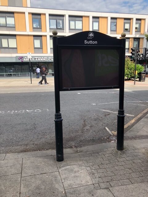
The community notice board in our Ward, in Brighton Road, has been restored after being demolished by a lorry.
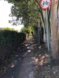
Sutton Council has declared that there is a climate emergency and at the Council meeting on 16 January we adopted a progress report entitled “Environment Strategy and Climate Emergency: Progress Report and Update.” In his speech on this important report Richard pointed out that far from being some vague affirmation of worthy sentiments the report was packed full of detailed, positive actions we had taken and could be proud of. He listed some of them
– ten new school streets
– 120 dockless ebikes (although we came quite late to the concept of ebike schemes compared to many London boroughs)
– double the number of new trees planted than our target
– seven parks received the green flag award for their biodiversity management with butterfly banks in the parks
– almost 7 000 teaching sessions on biodiversity, mostly to school age children
– the work of the Sutton Nature Conservation Volunteers, the Community Environment Champions Network, the Green Enterprise partnership
– the Healthy Homes Advice and Support Service, providing assessment of homes for energy efficiency
– promoting green spaces, energy efficiency and electric vehicles through our planning policies and decisions
– LED street lighting and electric vehicle charging points in street lamps
– promoting re-cycling of waste
– the promotion of initiatives to support locations where items can be repaired and re-used
– action to deal with extreme weather events
– promoting the cycling network and cycle maintenance and safety workshops
– travel plans for our own staff to promote cycling and walking, and switching our own vehicles to electric.
The list goes on and on.
This is an important programme based on positive, practical steps we are taking to protect the environment.
Planning issues have always been a major concern in Sutton South Ward, with numerous examples of poor quality developments we have seen off but others where local democracy has been overturned by the decisions of the remote Planning Inspectorate based in Bristol.
As Liberal Democrats, we think that an effective planning system based on local consultation is essential to maintaining the quality of development in our Ward. The system has been undermined by the Government, by extension of “permitted development” rights and by new provisions that make it possible to add two storeys to the top of a block of flats by going through truncated planning approval arrangements.
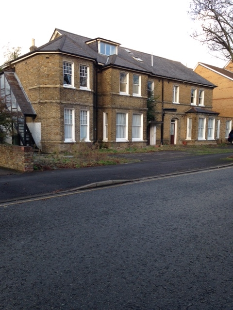
There has been a growing trend for developers to try to add extra storeys to the tops of blocks of flats. We have recently seen off three such proposals in our Ward, where the proposal would have made the building look incongruous and the building work would have been a nightmare for the current residents. The first of these was a block in Mulgrave Road, which failed to meet our standards of design – not good enough for Sutton. The second was in Grange Road – Magnolia Court. The third in Brighton Road – Northumberland House.
We need more housing, but not by agreeing to buildings that will be blots on the landscape for the next fifty years.
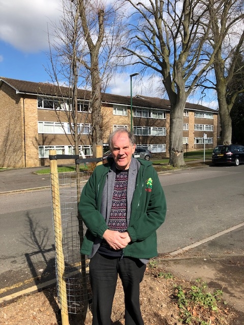
We have a manifesto commitment to plant more trees, to improve air quality, combat global warming and promote the green, suburban feel of Sutton. We will be planting new trees in the next few months in Downside Road, Upland Road, Willis Avenue and Prior Avenue.
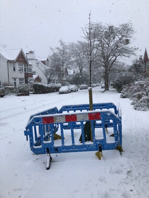
We were delighted when, in accordance with the commitment to plant more trees to combat global warming, two new trees were planted in early 2021 in The Ridgway. The story concerning the tree outside number 23 is interesting. Many years ago there was a tree pit here and a tree. The tree died. Contractors tarmaced over the tree pit. The tarmac would periodically sag. Richard suggested restoring the tree pit and planting a tree. This was done. The photo was taken during the brief fall of snow on 24 January 2021.
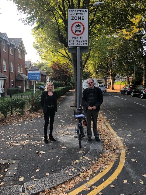
Students returning to school at the start of the 2020 autumn term at Overton Grange enjoyed a quieter and safer atmosphere due to the introduction of a “school street” at the gates in Stanley Road at the time students arrived and left for the school day. This involved the closure of the part of Stanley Road adjacent to the school for a short period in the morning and afternoon, when the school day starts and ends.
The objectives of school streets are:
1) To improve safety around the school at start and finish time
2) To improve air quality for children outside their school gates (small people are particularly vulnerable to emissions from cars)
3) To create a more welcoming atmosphere around the school, where children can walk in the road and parents can feel more relaxed.
The scheme was a six month trial funded by Transport for London, who set the parameters of the scheme. The scheme was withdrawn in advance of the conclusion of the six month trial following a legal challenge to the lawfulness of such schemes, but by then it was proposed to withdraw the scheme. This related to difficulties experienced in enforcing the traffic controls, which at successful “school street” schemes involved the participation of the school and parents.
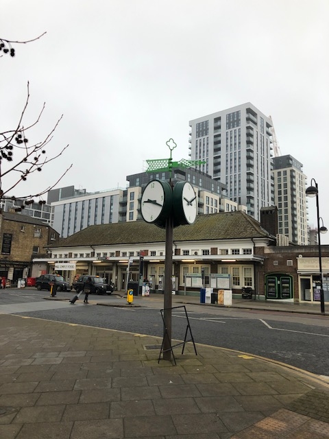
When Richard was first elected in 2010 one of the first projects he initiated was to get the “No Drinking Zone” in the centre of Sutton extended to our Ward. There were a group of what the police termed “all day drinkers” who used to congregate on Cedar Road outside Forest Dene Court.
The zone was extended to cover the area of our Ward south of the station as far as Cavendish Road, and running west to east from Brighton Road to Langley Park Road. In this area it is unlawful to continue to drink alcohol if asked by the police to stop, and there are provisions that would enable the police to confiscate alcohol. You will find reminders of the provisions attached to lampposts in the area, for example in Cedar Road.
The Council has, by law, to re-consider and consult afresh on these provisions from time to time. It is doing so at present. You can comment or make representations on the proposal to maintain these provisions. Representations must be made in writing and addressed to Safer Sutton Partnership Service, Environment, Housing and Regeneration Directorate, Sutton Police Station, 6 Carshalton Road, Sutton, SM1 4RF, before 21st September 2020. You need to state the grounds on which your representation or objection is made.
If you have any questions about this consultation, you can contact the Safer Sutton Partnership Team via email at safersutton@sutton.gov.uk.

The Local Government Boundary Commission for England has been reviewing the boundaries of the local Government Wards in Sutton prior to the next local elections in 2022.
They published draft proposals last year and have now published final decisions. You can view these on their website.
Their final decisions leave the Ward much as it was, with the addition of a part of Mulgrave Road. The new structure they outline will be the structure of Wards at the next Council elections in 2022. The new Ward will be one of the largest Wards in the borough.
Currently the Ward runs from Sutton station in the north to Devonshire Road in the south, and Banstead Road South in the east to Overton Road in the west. It is mostly a Ward of residential roads with three schools (Devonshire Avenue primary, Overton Grange, Eagle House school), one small park (the Devonshire Avenue Nature Area), three places of worship (Christchurch, the Friends’ Meeting House, the synagogue in Cedar Road), split into three parts by Langley Park Road and Brighton Road running north-south.
The draft proposals published earlier this year removed from the Ward roads east of Upland Road – Kaymoor, Willis, Prior, Downside, Farm Close – and put them into Carshalton Beeches Ward. There were minor adjustments at the western end so the whole Ward moved westwards.
In drawing up new boundaries, the Commission is required to aim to deliver electoral equality for voters in Council elections so that each Councillor represents roughly the same number of voters. The review also aimed to ensure that the new Council wards reflect, as far as possible, the interests and identities of communities across Sutton.
The final proposals leave the Ward much as it was, with the addition of a small part of Mulgrave Road. The new Ward will be one of the largest Wards in the borough.
After a debate on 14 October Sutton Council submitted some proposals. Richard spoke in this debate, commenting in particular on the proposals fro Sutton South Ward. He said:
“I recognise that there is always a tension between drawing lines on maps that create sensible geographical structures in terms of communities and natural boundaries and getting the numbers right in terms of residents per Councillor. I would like to stress that where these create tensions I think it important to give priority to getting the boundaries right, creating areas that residents recognise as communities, in particular respecting natural boundaries such as main roads and railway lines, and keeping recognised communities together, and this should be the priority even if it does lead to some unevenness in Ward sizes. In any exercise like this there will inevitably be some disparity in the size of Wards with some outliers.”
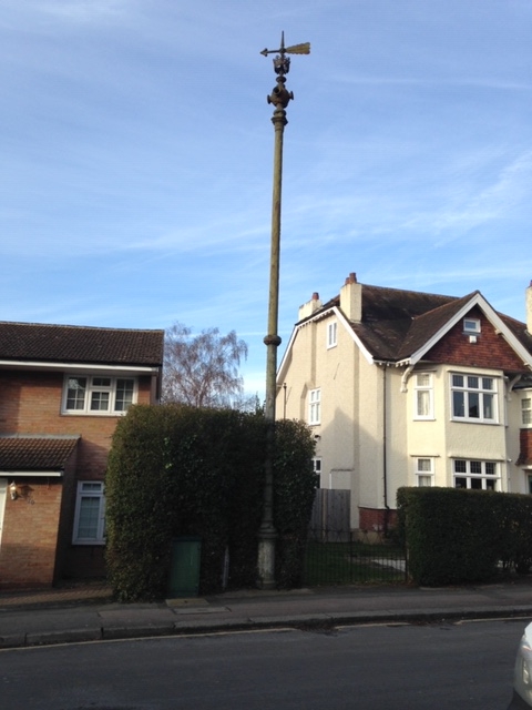
The Secretary of State for Digital, Culture, Media and Sport, advised by Historic England, has added to the National Heritage List for England the historic sewer pipe in Hillcroome Road.
This structure thus becomes the only structure in our Ward to be nationally listed as of historic and architectural significance, so it could only be altered or have work done on it if listed building consent was obtained. There are three other buildings in our Ward that are listed on the Local List of structures of local importance, which provides a lesser degree of protection. These are:
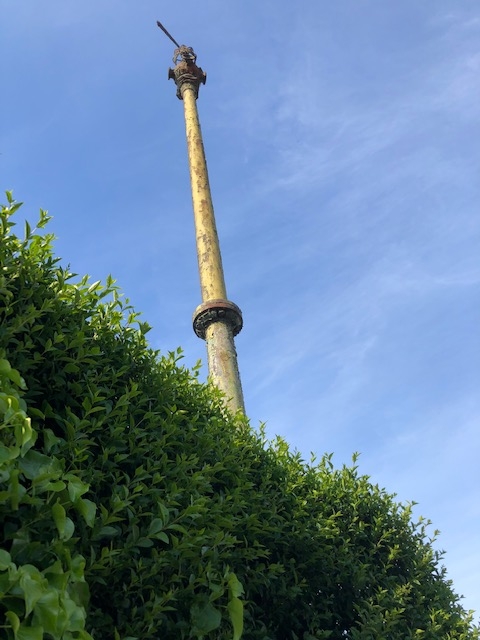
These Drain Pressure Release Pipes, also known as ‘Stink Pipes’, can be seen at various locations within the old Carshalton Urban District Council boundary. They have been listed on the basis of the criterion that they are important to the townscape view.
They were produced by W. Macfarlane & Co. of Glasgow, a prestigous Victorian Ironworks. The company employed imaginative designers and produced huge amounts of ornate and decorative ironwork. The pipes are extremely tall with an ornate top fixture comprising a large arrow, a globe with four trumpetlike funnels and a spike spire piercing a crown. The height and funnels may be to ensure the gas disperses efficiently so as not to inconvenience local residents. It is not known what purpose the arrow has, whether to indicate the direction of sewer flow or act as a weather vane to indicate wind direction.
They serve two purposes, firstly to prevent a build up of pressure in underground sewers in the event of a blockage, and secondly to vent off any hydrogen sulphide gas. This gas, which smells of rotten eggs, can build up when sewage becomes septic, on long runs, or when the speed of the sewage is slow in flat areas. It is extremely corrosive and can eat through the concrete pipes. The sewerage system would have become a necessity after the rapid increases in population and residences in Sutton and Carshalton at the end of the 1800s. Prior to this sewage would have been dispersed into cesspits and drainage ditches, with a risk of contamination of the drinking water supply, contributing to ill health.
The history of W. Macfarlane and Co. and their foundry, the Saracen Foundry, is fascinating. In 1851 Walter Macfarlane (1817-1885) established his company in a disused foundry in Saracen Lane in Gallowgate, Glasgow, and named it Saracen Foundry. It later moved to Washington Street, near the River Clyde. By 1872 his nephew, also named Walter MacFarlane (1853–1932), joined the rapidly expanding company and they relocated to Possilpark, a site of 100 acres on the outskirts of the city. Here a foundry with railway access and a village-styled infrastructure to house the workforce was built. In a decade it housed 10,000 people but the vast iron-founding site caused much pollution. The young MacFarlane made standardisation and good design the key to the company’s successful development. The foundry’s work was used on prestigous developments and widely distributed. During the Second World War Possilpark industrial works was a vast and well-lit target for attack. The recovery of iron to melt down for the war effort also removed much of Saracen’s work. After the war, the collapse of the British Empire, the move away from steam power and the use of new designs and materials led to a vast decline in orders. In 1967 the foundry at Possilpark closed.
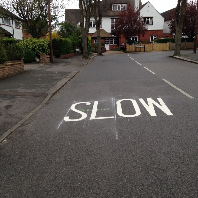
The Council’s programme for re-surfacing roads and pavements has been under pressure over recent years due to the impact of austerity and cuts to Government support to Councils. The Council has had to implement savings measures in order to survive, and it has been a struggle to maintain these programmes.
There is an annual programme of review of priorities for the resurfacing of roads and pavements and replacement of light columns. Last year, we were delighted by the re-surfacing of the pavement in Mayfield Road. The programme for the coming year includes more work in our Ward, including the re-surfacing of the footway in The Ridgway (pictured above) and the replacement of concrete light columns in a number of roads at the western end of the Ward –
We now have the results of the final stage of the Council’s consultation on parking. The third round of consultation was on a proposal developed from the results of the first two consultations, for a Permit Parking Area in roads in our Ward east of Langley Park Road.
WHAT HAPPENED IN THE EARLIER ROUNDS OF CONSULTATION
As parking is often raised as a problem in the regular surveys of residents on what they like about living in Sutton, the Council asked residents if parking was a problem in their road and what they would like done. Earlier rounds of consultation led to proposals that were not given sufficient support by residents for the Council to proceed with them.
There were concerns that unless the controls cover the whole local area parking will be displaced into roads without controls, and “free to park at any time” bays would be a magnet for commuters and long stay parkers, squeezing out residents. The alternative to schemes that have these disadvantages is a residents-only Permit Parking Area (PPA).
THE FINAL STAGE OF CONSULTATION
Consequently, the Council consulted residents at the end of 2019 on a proposed PPA. As roads not within the scheme will suffer from displaced parking if the roads nearby are in the scheme, the area consulted on was wide, running from Egmont Road to Willis Avenue and Prior Avenue – including Chalgrove Road, The Ridgway, Mayfield Road, Farm Road, Farm Close, Upland Road, Kayemoor Road, Downside Road, Willis Avenue and Prior Avenue.
The results of the consultation are clear – in every one of the roads listed above a majority of those expressing a view on the proposals supported their introduction. In some roads – particularly Chalgrove, Mayfield, The Ridgway, Upland – this was by a large margin. In all these roads more than one in four residents responded to the study, a high response rate for such local consultation exercises, and opinion was more than two to one in support of the proposed parking controls. In other roads consulted there was a lower response rate but still majorities in favour of the proposals. Once a scheme is introduced, any individual road left out will suffer high levels of parking, so any scheme needs to cover the whole area. It is a clear result that gives the Council a mandate to proceed with the introduction of the PPA consulted on.
The way the PPA works is that only residents can park their vehicles in the road for a “control period”, 9 to 11 AM each day on weekdays, thus removing commuters and long stay parkers. Residents who need to park a car on the road rather than in their drive during the “control period” will need to obtain a parking permit to display on the vehicle, and many residents will want to obtain “visitors’ permits” for their visitors if the visitors need to park in the street during the control period. There are special arrangements for carers. As this scheme will involve some costs of administration and enforcement there will be a charge for a permit, to cover costs, though all residents can get an initial supply of visitors’ permits without charge. The Council can cover costs but not use parking charges to subsidise other services. Parking charges in Sutton are amongst the lowest of any London borough. Charges per vehicle are on a scale you can find on the Council website and start at £40. A similar charge in Croydon is £80, Merton and Kingston £90, Richmond £99. You only need a permit if you need to park a car in the road during the “control period.” A PPA involves notices to advise motorists of the parking controls but there is no need for yellow lines.
Residents will receive a letter from the Council which will set out the timetable for introducing the scheme, later this year, and how to obtain permits.
Many residents are concerned about parking and we are pleased they have now had the opportunity to put their view on a concrete proposal developed on the basis of consultation, and a clear outcome has emerged.
SPEEDING AND POLLUTION
We are concerned that the removal of parking from the area will lead to clear roads that will attract more traffic and speeding. In many parts of London, though often more affluent areas, residents have campaigned to get the traffic out of otherwise quiet residential streets and onto the main roads by turning roads into cul-de-sacs, thus creating quiet roads with better air quality and no through traffic. A good example locally is the gate at the end of Dorset Road which makes Homeland Drive a quiet, traffic free road. We are interested in the proposals residents have been putting to us for consultation on such traffic initiatives in our area. Nothing is currently proposed but, as traffic continues to increase, this is the next issue we need to look at. Do let us know your views.