
Flooding is a topical subject at the moment, so Richard has welcomed a proposed study of possible flooding risks in South Sutton Ward as providing re-assurance to residents. This is despite the fact that there have been no significant flooding incidents in the Ward in the recent past.
Following a report to the Council’s Scrutiny Committee about water management and flooding, the Environment Agency has approved funding to develop three flood alleviation schemes in Sutton, including a scheme in Sutton South Ward.
The funding is for schemes to reduce the likelihood of flooding in the Hackbridge (London Road) area, in Sandy Lane Cheam by the railway bridge, and in the Brighton Road/Overton Grange area in Sutton South.
In total we have been awarded £123,500 to produce studies that identify the specific problems in each area, propose solutions and provide specifications, including costings, for necessary works.
The Environment Agency has stated that it will look favourably on providing funding for construction of any works proposed by the studies, so this is an important step towards sorting these problems out.
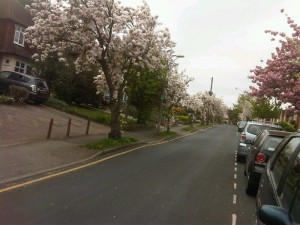
The Environment Agency’s modelling has suggested that there is an area of possible flood risk in South Sutton Ward, around Overton Grange school and the surrounding area. However, we have no known incidents of flooding in that specific area. Residents have advised us that some years ago there was a minor flooding incident at the foot of Copse Hill (pictured above), but changes to the drainage system at the foot of the hill (following discussions Richard held with relevant Council officers) is believed to have dealt with this issue. There has also been a brief flooding incident under the Grange Vale bridge when leaf fall blocked the drains, before Richard himself removed the obstruction.
Through discussion with the Environment Agency’s experts the Council has come to the conclusion that the surface water sewers in Brighton Road and adjoining streets, and the railway line, are probably affecting surface water flow, with the result that any actual flooding would be more likely to occur in Brighton Road and in the part of Cedar Road between the Brighton Road and Langley Park Road, this being the area that the sewers divert the water towards.
The proposal is to develop the scheme to protect these areas and to model the impact of proposed new arrangements. This should help us understand where the water is actually flowing now and the benefits any new flood infrastructure will bring.
Qualified consultants recommended by the Agency are about to start work on undertaking the investigations and design work.